

Dubai districts and areas are organised through a broader geographic and urban structure that divides the emirate into sectors, urban centres, districts, communities and neighbourhoods. This structure helps explain how Dubai’s huge urban area is arranged and how different parts of the city connect with one another.
Instead of viewing Dubai as one continuous city, it is more useful to understand it as a series of connected urban zones with different functions, densities and development patterns.
How Is Dubai Divided?
How is Dubai divided? Dubai is organised into geographic sectors, which are further broken down into smaller areas and communities.
For everyday use, people commonly use words such as area, district, community and neighbourhood interchangeably. However, these terms can describe different levels of the city’s geographic structure.
At a broad level, Dubai can be understood through:
- Geographic sectors
- Urban centres
- Districts
- Communities
- Neighbourhoods
This layered structure makes it easier to plan roads, public transport, infrastructure, housing, services and future development.
Dubai Creek: How the Waterway Shaped the City’s Growth
Dubai Geography: Coastline, Desert, Islands, Creek & Hatta
Dubai Geographic Sectors
Dubai geographic sectors are large planning divisions used to understand the emirate at a broader level.
Dubai is divided into nine geographic sectors. These sectors cover both densely developed urban areas and less-developed parts of the emirate.
The sectors are not simply nine separate cities. They are large geographical zones containing multiple smaller areas and communities.
This makes the sector level useful when looking at Dubai as a whole rather than focusing on individual neighbourhoods.
Where Is Dubai? Geography, Location, Size & Population
Dubai Urban Areas and Major Centres
Dubai urban areas are not all organised around one single downtown.
Dubai has developed multiple important urban centres, each serving different roles within the wider city.
The older urban centres grew around historic parts of Dubai, while newer centres developed around business, tourism, technology, exhibitions and other major activities.
This creates a more distributed city structure instead of everything being concentrated in one central district.
The Historic Urban Core
The older parts of Dubai form an important part of the city’s original urban structure.
Deira and Bur Dubai developed around Dubai Creek and became important centres for trade, commerce and settlement.
These areas have a different urban character from Dubai’s newer high-rise districts.
Their streets, buildings, markets and waterfront connections reflect an earlier stage of the city’s development and provide a link between Dubai’s historical urban structure and its modern expansion.
Dubai’s Business and Economic Centre
Dubai’s modern economic structure has created another major urban concentration around areas such as Downtown Dubai, Business Bay, Sheikh Zayed Road and the Dubai International Financial Centre.
This part of the city contains major offices, commercial buildings, financial institutions and high-density development.
Rather than being a single district, it functions as a connected economic zone made up of several major urban areas.
The concentration of employment and business activity has also influenced transportation patterns and the development of surrounding areas.
Dubai’s Coastal Urban Centre
Another major part of Dubai’s urban structure developed along the coast.
Areas around Dubai Marina, Jumeirah Lakes Towers and the wider waterfront corridor form an important modern urban concentration.
The physical character here is different from the historic Creek area and the central business zone. High-rise buildings, waterfront development and major transport corridors have created a distinct urban landscape.
This demonstrates how different parts of Dubai have developed around different geographical and economic functions.
New Growth Centres in Dubai
Dubai’s urban structure continues to expand beyond its traditional central areas.
Expo City Dubai represents one of the newer development centres associated with exhibitions, logistics, economic activity and future growth.
Dubai Silicon Oasis represents another important centre, particularly associated with technology, innovation and knowledge-based activity.
These newer centres are part of a broader effort to distribute development and services across different parts of Dubai rather than concentrating everything in the historic core.
What Is the Difference Between a District, Community and Neighbourhood?
The terms can be confusing because Dubai’s everyday area names do not always match how people use planning terminology.
A district is generally a larger urban area with a particular geographic or functional identity.
A community is a smaller unit within the wider city structure and may contain residential, commercial and public facilities.
A neighbourhood is generally smaller and more local, often representing the area where people live and access everyday services.
The important point is that these are layers of Dubai’s urban geography rather than completely separate types of places.
How Dubai’s Urban Structure Works
Dubai’s geographic structure can be visualised as a hierarchy.
Emirate → Urban Centres → Sectors → Districts → Communities → Neighbourhoods
Each level provides a different way of looking at the city.
At the emirate level, Dubai is a large geographical territory.
At the urban-centre level, the focus shifts to major concentrations of activity.
At the sector level, larger geographical zones become easier to analyse.
At the district, community and neighbourhood levels, the structure becomes increasingly local.
This layered approach allows Dubai to function as one connected metropolitan area while still having many distinct places within it.
Dubai’s Urban Density Is Not the Same Everywhere
One of the most noticeable features of Dubai city structure is the variation in density.
Some parts of the city contain dense clusters of towers, offices and apartments. Other areas are dominated by villas, lower-rise buildings, industrial uses, open land or large infrastructure.
This variation is intentional and reflects different land uses and planning requirements.
A high-density business district does not need to look or function like a low-density residential area, while an industrial zone requires a completely different physical structure.
Roads Help Connect Dubai’s Urban Areas
Dubai’s urban structure is strongly connected by major roads and transport corridors.
Large highways allow people and goods to move between different sectors and urban centres, while smaller roads connect individual districts and communities.
This interconnected road network is particularly important because Dubai’s development is spread across a large geographical area.
Public transport also plays an increasingly important role in connecting major urban concentrations and supporting movement between different parts of the city.
Dubai’s Urban Structure Is Designed for Growth
Dubai’s city structure is not fixed.
As the population grows and new economic activities emerge, previously less-developed areas can become new centres of development.
Urban planning therefore considers more than buildings alone. It also looks at transportation, infrastructure, public facilities, open spaces, housing, employment centres and access to essential services.
The long-term objective is to create a city where different parts of Dubai can function effectively without placing excessive pressure on one central area.
Dubai 2040 and the Future City Structure
The Dubai 2040 Urban Master Plan provides a long-term framework for the city’s spatial development.
Its approach focuses on improving the use of existing urban areas, strengthening connectivity, providing better access to services and creating more balanced development across Dubai.
The plan also considers how different levels of urban development should work together.
This means Dubai’s future structure is not simply about adding more buildings. It is about creating connected urban areas where housing, employment, transport, services, parks and other facilities can work together.
Why Dubai Has So Many Different Areas
Dubai’s large number of named areas is a result of the city’s rapid physical expansion and its different stages of development.
Some areas grew around historic settlements and trade routes. Others were planned as business centres, residential zones, technology hubs, industrial areas, transport centres or large mixed-use developments.
As Dubai expanded, these places became part of one increasingly connected metropolitan area.
This is why two parts of Dubai can look completely different while still being part of the same urban system.
Understanding Dubai Without Confusing It With Property Communities
It is important to distinguish Dubai’s geographic structure from property-focused descriptions of Dubai.
An area can be discussed geographically because of its position, urban form, transport connections or function within the city. A real estate guide, on the other hand, may focus on property prices, housing types, rental demand and investment opportunities.
This article looks at Dubai from a geographic and urban-planning perspective rather than as a property market.
Dubai’s City Structure in Simple Terms
The easiest way to understand Dubai is to imagine several layers.
The emirate is the largest geographical area.
Within it are broad sectors.
Major urban centres concentrate different types of economic and social activity.
Within those larger zones are districts and areas.
Smaller communities and neighbourhoods create the local structure where people live, work and access everyday services.
Together, these layers create the physical organisation of Dubai.
Conclusion
Dubai districts and areas form part of a much larger geographic structure built around sectors, urban centres, districts, communities and neighbourhoods.
The city does not have one single centre. Historic areas around Dubai Creek, major business zones, coastal urban centres and newer growth areas all contribute to the wider metropolitan structure.
This organisation allows Dubai to accommodate different land uses, population densities, transport requirements and economic activities across the emirate.
Understanding this structure makes it easier to see Dubai not as one giant collection of buildings, but as a connected network of urban areas that have developed for different purposes while functioning together as one city.

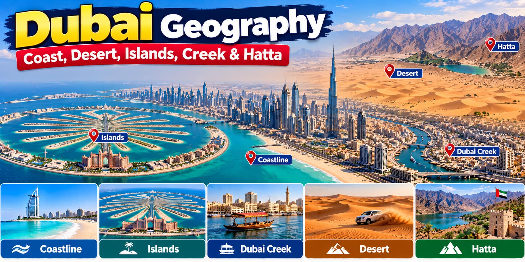








Dubai Geography: Coast, Desert, Islands, Creek & Hatta
[…] Dubai Districts and Areas: Sectors, Urban Centres & City Structure […]