Dubai Creek is one of the most important geographic features in Dubai and played a major role in shaping the city’s early formation. Long before Dubai became known for skyscrapers, highways and large-scale developments, the Creek provided a natural waterway where settlements, trade and maritime activities could develop.
The Creek was more than a body of water. It influenced where people settled, how the early city was divided, how goods moved and how Dubai developed into an important trading centre.
What Is Dubai Creek?
What is Dubai Creek? Dubai Creek is a natural saltwater inlet extending inland from the Arabian Gulf through the historic part of Dubai.
The waterway separates two of the city’s oldest urban areas: Deira on one side and Bur Dubai on the other.
Its sheltered waters made the area suitable for boats and maritime activity, giving early communities access to the Gulf while providing a protected route for local trade.
The Creek therefore became an important geographic foundation for the development of Dubai.
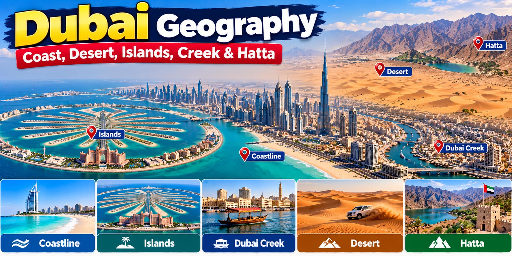
Dubai Geography: Coastline, Desert, Islands, Creek & Hatta
Why Is Dubai Creek Important to Dubai?
Why is Dubai Creek important? The Creek provided the physical setting around which much of early Dubai developed.
Its location offered several advantages:
- Access to the Arabian Gulf
- A sheltered waterway for boats
- A natural location for maritime trade
- Access to fishing grounds
- A connection between different parts of the settlement
- A place for markets and commercial activity to develop
These advantages helped transform the Creek from a natural geographic feature into the centre of Dubai’s early economic life.
Where Is Dubai? Geography, Location, Size & Population
Dubai Creek and the Formation of the City
The formation of Dubai city was closely connected with the Creek.
Early settlements developed along both sides of the waterway. Over time, these settlements became increasingly connected through trade, fishing and other maritime activities.
Deira became an important commercial area, while Bur Dubai developed on the opposite side of the Creek.
The waterway effectively created two connected urban centres rather than one settlement growing in a single direction.
This early pattern continues to influence the geography of Dubai today.
Deira and Bur Dubai: Two Sides of the Creek
Deira and Bur Dubai are central to understanding how Dubai developed around the Creek.
Deira became particularly important for commerce and trading activity. Its position beside the water made it convenient for merchants, boats and markets.
Bur Dubai developed on the opposite side and became another important centre of settlement and administration.
The Creek separated the two areas physically, but maritime activity also connected them economically.
This created a distinctive urban structure in which the waterway was both a boundary and a connection.
Dubai Districts and Areas: Sectors, Urban Centres & City Structure
Dubai Creek and Maritime Trade
Dubai Creek trade became an important part of the city’s economic development.
Small wooden boats could use the sheltered waters of the Creek to transport goods between the Gulf and the developing settlement.
Merchants used the waterfront for loading, unloading and exchanging goods. Markets grew close to the water, creating a direct relationship between maritime transport and commercial activity.
The Creek therefore became part of a larger trading network connecting Dubai with other ports around the Gulf and beyond.
Dubai Creek and Fishing
Fishing was another important activity connected with the Creek.
Before Dubai developed into a modern commercial city, coastal communities depended heavily on the sea for food and income.
The Creek provided access to the Gulf and offered a convenient location for boats involved in fishing activities.
This maritime way of life helped shape the early identity of Dubai and created communities whose daily activities were closely connected with the water.
Dubai Creek and the Pearl Trade
The sea was also central to Dubai’s traditional economy through pearl diving.
Pearling required boats, experienced crews and access to the Gulf. The Creek provided a sheltered base where boats could operate, prepare for journeys and return after spending time at sea.
The pearl trade connected Dubai with wider markets and contributed to the development of its commercial culture.
Although the importance of pearling declined dramatically with changes in the regional economy, its relationship with the Creek remains part of Dubai’s early economic history.
How Dubai Creek Influenced Urban Growth
The geography of the Creek affected the direction in which Dubai expanded.
Instead of developing as a simple inland settlement, the city grew around a waterway that divided the urban area into two major sides.
This influenced the location of:
- Markets
- Warehouses
- Homes
- Ports
- Trading areas
- Roads
- Bridges
- Waterfront businesses
As the population and economy grew, infrastructure was developed to improve connections between the two sides.
The Creek therefore influenced not only where Dubai began but also how the city expanded around its original urban core.
Dubai Creek as a Natural Boundary
One of the most interesting aspects of Dubai Creek geography is that the waterway functioned as a natural boundary.
Deira and Bur Dubai were physically separated by water, creating two distinct areas within the growing settlement.
At the same time, the Creek was never a complete barrier because boats provided an early form of transportation between the two sides.
Later, bridges and other infrastructure made the connection easier and allowed the two sides to become part of an increasingly integrated city.
How Dubai Connected the Two Sides of the Creek
As Dubai expanded, crossing the Creek became increasingly important.
Traditional boats provided an early connection between Deira and Bur Dubai. These small wooden passenger boats, known as abras, remain closely associated with the Creek.
Later, bridges and modern transport infrastructure created additional connections between the two sides.
This gradual change reflects Dubai’s wider development: a traditional water-based city gradually became a modern metropolitan area while retaining its original geographical structure.
Dubai Creek and the Growth of Old Dubai
Old Dubai developed around the Creek and remains one of the clearest places to understand the city’s early urban form.
The streets, markets, waterfront areas and traditional buildings around the Creek are different from the high-rise districts that dominate modern Dubai.
This contrast is geographically important because it shows how the city developed in stages.
The Creek represents the physical foundation of an older Dubai, while the surrounding modern skyline represents the enormous expansion that came later.
Dubai Creek in the Modern City
Dubai Creek remains an important part of the city’s geography even though Dubai has expanded far beyond its original waterfront.
Modern roads, bridges, buildings and infrastructure now surround the waterway, but the basic geographic division between Deira and Bur Dubai remains visible.
The Creek also continues to support marine transport and waterfront activity.
It has therefore retained its physical presence while becoming part of a much larger urban environment.
Dubai Creek and the City’s Changing Landscape
The development of Dubai did not remove the importance of the Creek.
Instead, the city grew around it.
As Dubai expanded inland and along the coast, new urban centres developed far beyond the original Creek area. Downtown Dubai, Business Bay, Dubai Marina and other modern districts created a much larger metropolitan structure.
Despite this expansion, the Creek remains a reference point for understanding where the city’s historic urban development began.
Why Dubai Did Not Develop as One Single Centre
The geography of the Creek helps explain why Dubai has several distinct urban areas today.
The original settlement developed around the waterway, with Deira and Bur Dubai forming two important centres.
As the city expanded, development moved outward along roads, the coastline and inland areas.
New business, residential and commercial centres gradually emerged.
This created the multi-centre urban structure that characterises modern Dubai.
The Creek was therefore not simply the location of an old neighbourhood. It was one of the geographical features that influenced the city’s long-term pattern of expansion.
Dubai Creek and the Identity of the City
The modern image of Dubai is dominated by skyscrapers, luxury developments and large infrastructure projects.
But Dubai Creek history represents a very different side of the city.
It reflects a period when Dubai’s economy and daily life were closely connected with fishing, pearling, boats and maritime trade.
The Creek provides a physical link between that earlier city and the modern metropolis.
This makes it an important geographical feature as well as a historical one.
The Creek as a Link Between Old and New Dubai
Dubai’s development can be understood as a gradual expansion from the Creek outward.
The early settlement depended heavily on the waterway. Later, the city expanded through roads, bridges, ports and modern infrastructure.
Today, the Creek sits within a much larger metropolitan landscape, but its location still helps explain the origins of the city.
It is one of the few physical features around which both historic and modern Dubai can be understood.
Dubai Creek and the Geography of City Formation
The story of Dubai city formation shows how geography can influence urban development.
The Creek provided water access, shelter for boats and a natural location for settlement. These advantages encouraged trade and maritime activities, which attracted people and businesses.
As economic activity increased, settlements expanded on both sides of the water.
Infrastructure then connected these areas, creating the foundation for a larger city.
In this way, a natural geographic feature became one of the starting points for Dubai’s urban development.
Conclusion
Dubai Creek was one of the geographic foundations of the city.
Its sheltered waters supported fishing, pearling and maritime trade, while its location encouraged settlements to develop on both sides. Deira and Bur Dubai became important early urban centres, and the Creek influenced the location of markets, businesses, homes and transport connections.
As Dubai expanded far beyond its original waterfront, the city developed new districts and modern urban centres. Yet the Creek remains an important geographical reference point for understanding how Dubai began and how its urban structure evolved.
From a natural waterway supporting a small trading settlement to a feature surrounded by a modern global city, Dubai Creek remains one of the clearest links between the geography of old Dubai and the city that exists today.